This function uses the instantaneous wind measurement (TWD and TWA) from the NMEA flow.
The SailChart used is the one selected in the routing menu.
Activate the dry point compass, the best sail is displayed in the information bubble.
This function is convenient to anticipate the sail to be used on the next leg.
In the example below, I am upwind towards the buoy “Roche du Sud”.
What will be our speed and the sail to use on the next leg between “Roche du Sud” and Aix NW?
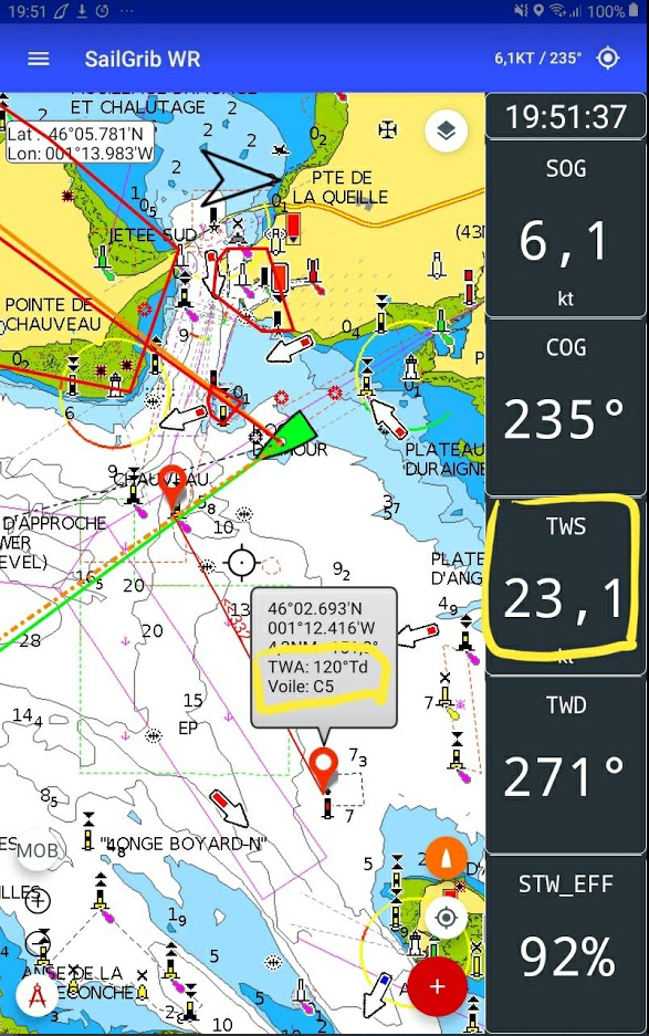
We will be on starboard tack with a 120° true wind angle, under Code 5