This function uses the instantaneous wind measurement (TWD and TWA) from the NMEA flow.
The SailChart used is the one selected in the routing menu.
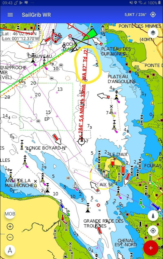
If the option “Boat to map center line” is checked in the Settings > GPS NMEA AIS menu, the distance, heading, TWA and optimal sail indications are displayed.
In this example, if we hit the AIXNW buoy located at 5.6Nm in the 184°, we will besailing with a 87° TWA and the optimal sail will be our J2.