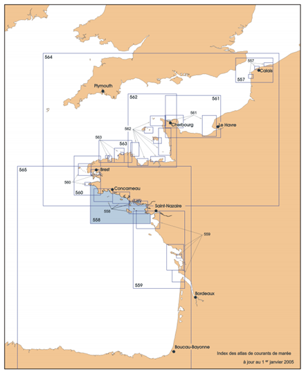
SHOM publishes tidal current atlases for the coasts of metropolitan France, the Channel and the Atlantic. They map the direction and intensity of tidal currents at each “tide” hour relative to a reference harbor. These atlases are developed from two-dimensional numerical models and validated in situ.
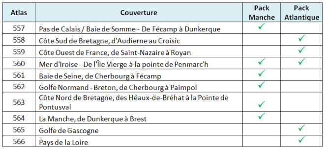
Each atlas can contain different precision zones. For example, Atlas 558 covers the southern coasts of Brittany from Audierne to Croisic. It contains the South Brittany, Glénan, Groix, Quiberon and Morbihan zones.
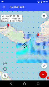
In sensitive areas like the entrance to the Gulf of Morbihan, these atlases are much more accurate than those provided free in the application.
The atlases are grouped into 2 “packs”, one for the Channel and the other for the Atlantic. Each pack is offered at 33€ HT. The price including VAT depends on the country of purchase. It is 39.99€ for a purchase made from France.
If you want more details on these atlases, the purchase and activation procedures, get the dedicated user guide.